

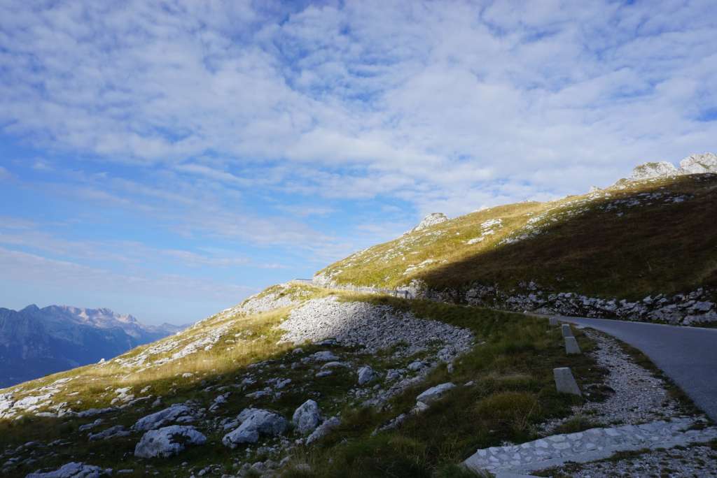
Located into the western Julian Alps mountain range with ends of the Mangart and Trenta Valleys, Mangart (2,679 metres, 8,789 ft) is rocky-splendid and plentiful of stunning horizons.
Mangart is a must-do for via ferrata lovers! This dramatic rocky peak in the western Julian Alps offers breathtaking climbs and endless horizons. Located where the Mangart and Trenta valleys meet, Mangart (2,679 m / 8,789 ft) is Slovenia’s fourth-highest peak, after Triglav, Škrlatica, and Mali Triglav. Whether you call it Mangart or Mangrt, the name hardly matters—this mountain delivers an unforgettable adventure either way.
As the Trek Goat blogger, I’m drawn to rocky landscapes—stones are, after all, our natural home turf. Mangart is especially popular in summer thanks to its relatively easy access. The name “Mangart” refers not only to the summit itself, but to an entire mountain range that includes Veliki Mangart (2,679 m), Koritniški Mali Mangart (2,333 m), Rateški Mali Mangart (2,289 m), and nearby peaks such as Kotova špica, V koncu špica, and Vevnica (around 2,350 m). Vevnica marks the divide between the Koritnica Valley and Mangartska Dolina.
On the northern (Italian) side, two beautiful lakes—Donje and Gornje Belopeško jezero (Lago di Fusine)—lie below. On the south (Slovenian) side, the Koritnica River springs and carves the Loška Koritnica valley. The south slopes rise a massive 2,000 m above the valley floor, while the north face towers 1,300 m over Italy.
Hiking Directions to Mangart (2,679 m)
The famous Mangart Road—Slovenia’s highest drivable road—climbs over 2,000 m to Mangartsko Sedlo (Mangart Saddle), right below the rocky summit pyramid. From there, two main routes lead to the top:
The Slovenian route (via ferrata) is challenging and exposed—it requires a full via ferrata kit (harness, lanyards, carabiners) and good technique. The Italian route (Via Normale / Via Italiana) is easier overall, with less exposure (some sections still have cables), and can be done without full via ferrata gear if you’re experienced.
Note: The short, easy path from Mangartsko Sedlo is only part of the Italian route. The full classic Italian ascent starts much lower at Belopeška Jezera (Laghi di Fusine / Mangart Lakes) and is longer and more demanding.
Mangart from Mangartsko sedlo: Slovenian route ascent and Italian route descent
This loop combines the thrilling Slovenian via ferrata up and the easier Italian route down—perfect for a full experience.
Access to the starting point
From the Kranjska Gora direction (via Ljubljana → Kranj → Jesenice): Exit for Kranjska Gora, follow road 201. Continue through Rateče (border) toward Tarvisio (Italy), then turn left toward Bovec/Predel border. Just after crossing back into Slovenia, turn left for Mangartsko Sedlo. Follow the narrow, winding, toll road (with tunnels) to the parking at ~2,050 m.
From Kranjska Gora, take the famous Ruska cesta (Russian Road) over Vršič Pass toward Trenta, then follow the signs for Log pod Mangartom → Mangartsko Sedlo.
From the Soča/Bovec direction: Drive to Bovec, then continue toward the Predel border crossing. A few hundred metres before the border—just after the large arched bridge—turn right toward Log pod Mangartom / Mangartsko Sedlo. Follow the narrow, serpentine toll road (including several tunnels) up to the parking area. The parking lot is located at Mangartsko Sedlo (approximately 2,050–2,072 m). Just below it stands the Koča na Mangartskem sedlu hut (2,044 m).
Trail Description Mangartsko Sedlo (2,167 m) → Mangart Peak (2,679 m)
This route is only for those comfortable with steel cables, very exposed sections, and airy passages.
From the highest point of the saddle, look for a path crossing the grassy slope toward Mangart. Follow the signs to the junction, where the Slovenian route turns right and the Italian route heads west, climbing diagonally up the western face through a ravine. The Slovenian path begins with a few exposed sections, but the real challenges lie higher up. After passing through a rocky notch, the route ascends a very steep gully with few switchbacks and limited protection in places—using both hands for secure movement is essential.
Stay close to the edge (with huge drops below), watch for loose, crumbly rock (don’t dislodge stones), and follow red markings. No major navigation issues—reach the summit without trouble. A wooden cross marks the top.
Mangart Peak (2679)
Straddling the Slovenia–Italy border, the summit delivers epic views—especially to the north, where the turquoise Laghi di Fusine (Belopeška jezera) shimmer below the sheer north face. It’s easy to see why this peak is so popular. Come for the breathtaking landscapes and stay for the thrill of the climb.
Descent: Via Normale (Italian Route) – Mangart → Mangartsko Sedlo
From the summit’s eastern side, follow faded markings down. Initially descend on the Slovenian side for ~20 minutes, then turn left at a marked junction into Italy (right/straight leads toward Jalovec).
The Italian path is mostly easy: grassy terrain with scattered stones, some smooth slabs (slippery when wet—cables help here). A few protected sections, but far less exposed than the Slovenian route. It eventually rejoins your ascent path—follow it back to the saddle.
Practical tips for hiking Mangart
Best time to go. Late June to early October. Avoid rainy days, as the rock becomes extremely slippery.
Starting point. Parking lot at Mangartsko Sedlo (around 2,050 m).
Via ferrata gear. Helmet, harness, and ferrata set are essential; gloves are recommended. The Slovenian route is exposed.
Route combination. Ascent via the Slovenian route (via ferrata), descent via the Italian route (Via Normale).
Fitness level. Moderate to advanced for the via ferrata; beginner to moderate for the Italian route.
Safety. Stonefall is common—helmets are mandatory. Avoid the route in unstable weather.
Trail duration. Approximately 3–5 hours in total, depending on pace and route. The Slovenian route is much shorter but more technical.
Conclusion. This rocky climb is one of Slovenia’s most visited via ferratas—via ferrata fans will love it from either side. The Slovenian route from Mangartsko Sedlo is less demanding than the full Italian Via Italiana (starting from Laghi di Fusine), but still thrilling all the way to the top. The longer Italian route has more landslide risk due to crumbling terrain. Both routes are well-secured in dry conditions, with no extreme difficulties—but always use a self-insurance kit (harness + lanyards) and wear a helmet (falling stones are common on rocky/scree sections). For hikers who prefer to avoid via ferrata, the Italian Via Normale from Mangartsko Sedlo offers a short, non-technical route to one of the Julian Alps’ finest peaks—no special equipment required beyond sturdy boots and a careful step. Whether you’re seeking a touch of adrenaline or sweeping alpine views, Mangart delivers. The Goat wholeheartedly recommends it—go and climb those rocks.
Accommodation nearby
- Koča na Mangartskem sedlu (small hut, perfect for a coffee or short rest)
- Lodges in Bovec or Kranjska Gora